-40%
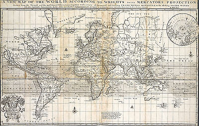
1705 Map of the World According To Wrights Mercators Projection Print 11"x16"
$ 6.6
- Description
- Size Guide
Description
1705 Map of the World According To Wright's Alias Mercator's ProjectionDetailed Specifications
This is a reproduction of the original map.
Map Size: 11"x16"
This Map Comes in other Sizes too:
16"x25" and 23"x36"
You can find them and more
World Maps
in
Our Store
All Our Posters and Maps Are Made in the USA
Shows California as an island, a incomplete Australia, a portion of the West
Coast of New Zealand, NE Coast of Asia, including The Land of Iesso, no Norhtwest
Coast of America and a host of other interesting details.
The map shows the various trade winds and currents, along with a inset of the
North Pole.
This map comes with a white border around the image
---------------------------
-How are the prints shipped?
They are rolled and placed into a rigid tube.
-Is this available in a larger/smaller size.
Yes. For smaller or larger sizes, email us.


